1. 配置 gdal
1.1. 官网下载

这个是因为你电脑是 win64 位才选择哦~
下载这个,然后解压
1.2. 复制这个压缩包下的 ddl 文件
可以按照类型复制,然后复制到你的 java jDK 文件夹下

1.3. 找到你的 java jdk 文件夹
不知道 java 的文件夹位置,可以通过这个查找
1.4. 复制对象
将这个复制到这个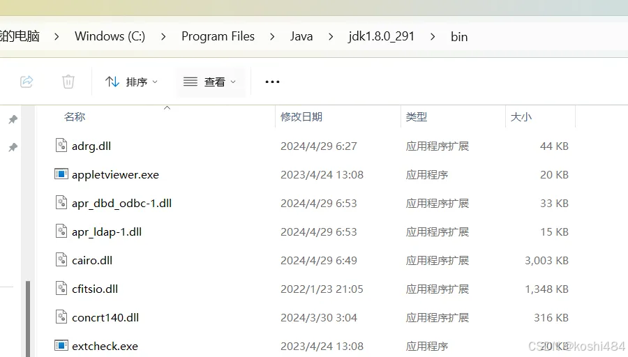
 1.5. 选择 release-1930-x64-gdal-3-8-5-mapserver-8-0-1\bin\gdal\java
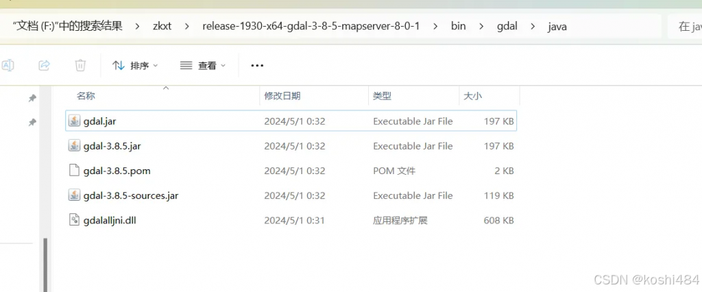
也复制到 java/bin java/jre/java,并且放入项目里面
2. 解析 tif
package org.example.flink_springboot.geop;

import org.gdal.gdal.Band;
import org.gdal.gdal.Dataset;
import org.gdal.gdal.Driver;
import org.gdal.gdal.gdal;
import org.gdal.gdalconst.gdalconst;
import org.gdal.gdalconst.gdalconstConstants;

public class GDALTest {
	public static void main(String[] args) {
		// 注册文件格式
		gdal.AllRegister();
		// 使用只读的方式打开图像
		Dataset poDataset = gdal.Open("F:\\learn\\flink_springboot\\src\\main\\resources\\srtm_60_05.tif", gdalconst.GA_ReadOnly);
		if (poDataset == null) {
			System.out.println("The image could not be read.");
		} else {
			// 图像打开成功
			System.out.println("The image could be read.");

			Driver hDriver = poDataset.GetDriver();
			// 输出文件的格式
			System.out.println("文件格式:" + hDriver.GetDescription());
			//System.out.println("文件格式:" + hDriver.getShortName() + "/" + hDriver.getLongName());
			// 输出图像的大小和波段个数
			System.out.println("size is:x:" + poDataset.getRasterXSize() + " ,y:" + poDataset.getRasterYSize()
					+ " ,band size:" + poDataset.getRasterCount());
			// 输出图像的投影信息
			if (poDataset.GetProjectionRef() != null) {
				System.out.println("Projection is " + poDataset.GetProjectionRef());
			}
			// 输出图像的坐标和分辨率信息
			double[] adfGeoTransform = new double[6];
			poDataset.GetGeoTransform(adfGeoTransform);
			System.out.println("origin : " + adfGeoTransform[0] + "," + adfGeoTransform[3]);
			System.out.println("pixel size:" + adfGeoTransform[1] + "," + adfGeoTransform[5]);


			// 分别输出各个波段的块大小,并获取该波段的最大值和最小值,颜色表信息
			for (int band = 0; band < poDataset.getRasterCount(); band++) {
				Band poBand = poDataset.GetRasterBand(band + 1);
				System.out.println("Band" + (band + 1) + ":" + "size:x:" + poBand.getXSize() + ",y:" + poBand.getYSize());
				Double[] min = new Double[1];
				Double[] max = new Double[1];
				poBand.GetMinimum(min);
				poBand.GetMaximum(max);
				if (min[0] != null || max[0] != null) {
					System.out.println("Min=" + min[0] + ",max=" + max[0]);
				} else {
					System.out.println("No Min/Max values stored in raster.");
				}
				if (poBand.GetColorTable() != null) {
					System.out.println("band" + band + "has a color table with"
							+ poBand.GetRasterColorTable().GetCount() + "entries.");
				}

				int buf[] = new int[poDataset.getRasterXSize()];
				for (int i = 0; i < 3; i++) {
					poBand.ReadRaster(0, i, poDataset.getRasterXSize(), 1, buf);
					for (int j = 0; j < 3; j++)
						System.out.print(buf[j] + ", ");
					System.out.println("\n");
				}
			}


			poDataset.delete();


		}
	}
}
3. 解析 shp
package org.example.flink_springboot.shape;

import org.gdal.gdal.gdal;
import org.gdal.ogr.*;
import org.gdal.osr.SpatialReference;

import java.util.HashMap;
import java.util.Map;

public class GdalDemo_shp1 {
    public void opeanShp(String strVectorFile ) {

// 注册所有的驱动
        ogr.RegisterAll();
// 为了支持中文路径,请添加下面这句代码
        gdal.SetConfigOption("GDAL_FILENAME_IS_UTF8", "YES");
// 为了使属性表字段支持中文,请添加下面这句
        gdal.SetConfigOption("SHAPE_ENCODING", "CP936");
// 读取数据,这里以ESRI的shp文件为例
        String strDriverName = "ESRI Shapefile";
// 创建一个文件,根据strDriverName扩展名自动判断驱动类型

        org.gdal.ogr.Driver oDriver = ogr.GetDriverByName(strDriverName);

        if (oDriver == null) {
            System.out.println(strDriverName + " 驱动不可用!\n");
            return;
        }
        DataSource dataSource = oDriver.Open(strVectorFile);
        //Layer layer = dataSource.GetLayer("test");
        Layer layer = dataSource.GetLayer(0);

        for(int i = 0;i<dataSource.GetLayerCount();i++) {
            Layer layerIdx = dataSource.GetLayer(i);
            System.out.println("图层名称:<==>" + layerIdx.GetName());
        }

        String layerName = layer.GetName();
        System.out.println("图层名称:" + layerName);
        SpatialReference spatialReference = layer.GetSpatialRef();
//System.out.println(spatialReference);
        System.out.println("空间参考坐标系:" + spatialReference.GetAttrValue("AUTHORITY", 0)
                + spatialReference.GetAttrValue("AUTHORITY", 1));

        double[] layerExtent = layer.GetExtent();

        System.out.println("图层范围:minx:" + layerExtent[0] + ",maxx:" + layerExtent[1] + ",miny:" + layerExtent[2] + ",maxy:" + layerExtent[3]);


        FeatureDefn featureDefn = layer.GetLayerDefn();

        int fieldCount = featureDefn.GetFieldCount();

        Map<String,String> fieldMap = new HashMap<String,String>();
        for (int i = 0; i < fieldCount; i++) {
            FieldDefn fieldDefn = featureDefn.GetFieldDefn(i);
            // 得到属性字段类型
            int fieldType = fieldDefn.GetFieldType();
            String fieldTypeName = fieldDefn.GetFieldTypeName(fieldType);
            // 得到属性字段名称
            String fieldName = fieldDefn.GetName();
            fieldMap.put(fieldTypeName, fieldName);
        }
        System.out.println();
        System.out.println("fileMap:");
        System.out.println(fieldMap);

        System.out.println(layer.GetFeature(1).GetGeometryRef().ExportToJson());
        System.out.println(layer.GetFeature(2).GetGeometryRef().ExportToJson());
        System.out.println(layer.GetFeature(3).GetGeometryRef().ExportToJson());

        for (int i = 0; i < 12; i++) {
            Feature feature = layer.GetFeature(i);
            Object[] arr = fieldMap.values().toArray();
            for (int k = 0; k < arr.length; k++) {
                String fvalue = feature.GetFieldAsString(arr[k].toString());
                System.out.println(" 属性名称:" + arr[k].toString() + ",属性值:" + fvalue);
            }
        }
    }

    public static void main(String[] args) {
        GdalDemo_shp shp = new  GdalDemo_shp();
        String strVectorFile ="F:\\learn\\flink_springboot\\src\\main\\resources\\中华人民共和国.shp";
        String info = shp.opeanShp(strVectorFile);
        System.out.println(info);
    }
}
package org.example.flink_springboot.shape;
import java.io.File;
import java.io.IOException;
import java.io.Serializable;
import java.util.Map;
public class SHP {
/**
* 生成shape文件
*
* @param shpPath 生成shape文件路径(包含文件名称) filepath
* @param encode 编码 code
* @param geoType 图幅类型,Point和Rolygon
* @param shpKey data中图幅的key geomfiled
* @param attrKeys 属性key集合 keylist
* @param data 图幅和属性集合 datalist
*/
public void write2Shape(String shpPath, String encode, String geoType, String shpKey, List<ShpFiled> attrKeys, List<Map<String, Object>> data) {
WKTReader reader = new WKTReader();
try {
//创建shape文件对象
File file = new File(shpPath);
Map<String, Serializable> params = new HashMap<>();
params.put(ShapefileDataStoreFactory.URLP.key, file.toURI().toURL());
ShapefileDataStore ds = (ShapefileDataStore) new ShapefileDataStoreFactory().createNewDataStore(params);
//定义图形信息和属性信息
SimpleFeatureTypeBuilder tb = new SimpleFeatureTypeBuilder();
tb.setCRS(DefaultGeographicCRS.WGS84);
tb.setName("sx_test");
tb.add("the_geom", getClass(geoType));
for (ShpFiled field : attrKeys) {
tb.add(field.getFiledname().toUpperCase(), getClass(field.getType()));
}
ds.createSchema(tb.buildFeatureType());
//设置编码
Charset charset = Charset.forName(encode);
ds.setCharset(charset);
//设置Writer
FeatureWriter<SimpleFeatureType, SimpleFeature> writer = ds.getFeatureWriter(ds.getTypeNames()[0], Transaction.AUTO_COMMIT);
// 写入文件信息
for (int i = 0; i < data.size(); i++) {
SimpleFeature feature = writer.next();
Map<String, Object> row = data.get(i);
Geometry geom = reader.read(row.get(shpKey).toString());
feature.setAttribute("the_geom", geom);
for (ShpFiled field : attrKeys) {
if (row.get(field.getFiledname()) != null) {
feature.setAttribute(field.getFiledname().toUpperCase(), row.get(field.getFiledname()));
} else {
feature.setAttribute(field.getFiledname().toUpperCase(), null);
}
}
}
writer.write();
writer.close();
ds.dispose();
//添加到压缩文件
//zipShapeFile(shpPath);
} catch (IOException e) {
e.printStackTrace();
}catch (Exception e) {
e.printStackTrace();
}
}
/**
* 更新shp文件数据
*
* @param path 文件路径
* @param datalist 空间及属性数据
*/
public static void updateFeature(String path, List<Map<String, Object>> datalist,String code) {
ShapefileDataStore dataStore = null;
File file = new File(path);
Transaction transaction = new DefaultTransaction("handle");
try {
dataStore = new ShapefileDataStore(file.toURL());
Charset charset = Charset.forName(code);
dataStore.setCharset(charset);
String typeName = dataStore.getTypeNames()[0];
SimpleFeatureStore store = (SimpleFeatureStore) dataStore.getFeatureSource(typeName);
// 获取字段列表
SimpleFeatureType featureType = store.getSchema();
List<String> fileds = getFileds(featureType);
store.setTransaction(transaction);
WKTReader reader = new WKTReader();
for (Map<String, Object> data : datalist) {
Filter filter = null;
if (data.get("where") != null) {
filter = ECQL.toFilter(data.get("where").toString());
}
Object[] objs = new Object[] {};
String[] str = new String[] {};
if (data.get("geom") != null) {
Geometry geometry = reader.read(data.get("geom").toString());
str = add(str, "the_geom");
objs = add(objs, geometry);
}
for (String stri : fileds) {
if (data.get(stri) != null) {
str = add(str, stri);
objs = add(objs, data.get(stri));
}
}
store.modifyFeatures(str, objs, filter);
}
transaction.commit();
System.out.println("========updateFeature====end====");
} catch (Exception eek) {
eek.printStackTrace();
try {
transaction.rollback();
} catch (IOException e) {
// TODO Auto-generated catch block
e.printStackTrace();
}
}
}
/**
* 移除shp中的数据
* @param path 文件路径
* @param ids 字段值数组
* @param filed 字段名
*/
public static void removeFeature(String path, List<String>ids,String filed,String code){
ShapefileDataStore dataStore = null;
File file = new File(path);
Transaction transaction = new DefaultTransaction("handle");
try {
dataStore = new ShapefileDataStore(file.toURL());
Charset charset = Charset.forName(code);
dataStore.setCharset(charset);
String typeName = dataStore.getTypeNames()[0];
SimpleFeatureStore store = (SimpleFeatureStore) dataStore.getFeatureSource(typeName);
store.setTransaction(transaction);
Filter filter = null;
if(ids.size()>0) {
String join = filed +" in ("+StringUtils.join(ids,",")+")";
System.out.println(join);
filter = ECQL.toFilter(join);
}
if(filter!=null) {
store.removeFeatures(filter);
transaction.commit();
System.out.println("======removeFeature== done ========");
}
} catch (Exception eek) {
eek.printStackTrace();
try {
transaction.rollback();
} catch (IOException e) {
// TODO Auto-generated catch block
e.printStackTrace();
}
}
}
}